In 2018, we became the comprehensive field-services provider and lands manager in California for 187,000 acres. The lands consist of a high-quality expanse of sustainably-managed interior and coastal California timberlands. In 2019, Director of Informatics, Weikko Jaross, seized the attention of our clients and their investors to seek actionable strategies for “de-risking” the asset. We utilized this timberland risk approach and other metrics to provide a risk-informed, spatially-optimized harvest plan to reduce their risk of fire loss and, in the process, demonstrated a rationale for lower risk premiums at appraisal.
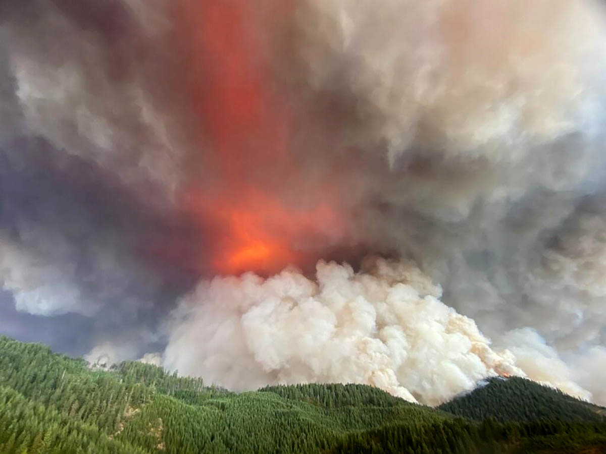
Wildfires in the Western United States seemed to have gone from bad to worse. By the end of the 2020 wildfire season, over 7.3 million acres of land had burned and around 16,000 structures were destroyed in the Western US alone, with fire suppression costs over $2.7 billion dollars.* The properties we managed were spared. Yet, many of our communities were impacted.
“The need to get actionable information out to all timberland owners in the west was clear and present,” said Sam Porter, Managing Director of Western Timberlands.
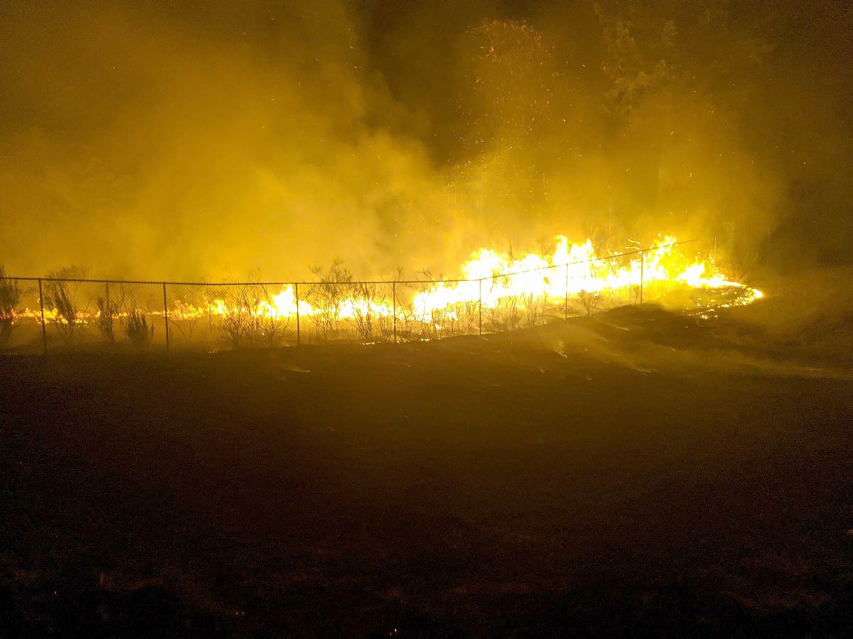
In 2020, we witnessed the Pacific Coast catch on fire like we’ve never seen it before, and it seemed like the record-breaking season would never end. In August, there were severe, dry thunderstorms igniting fires throughout Washington, Oregon, and California. In early September, all of these states experienced a record-breaking heatwave, combined with historic high winds, fueling the rapid growth of existing fires and sparking many more. While this past fire season would almost seem anomalous, wildfires continue to pose a threat to timberlands throughout the Western US, and it is more important than ever to make sure that timberland owners understand their risk. But therein lies the question: how do you know if your timberland property is impacted by wildfire risk?
Timberland Fire Risk Portal: www.landvest-firerisk.com
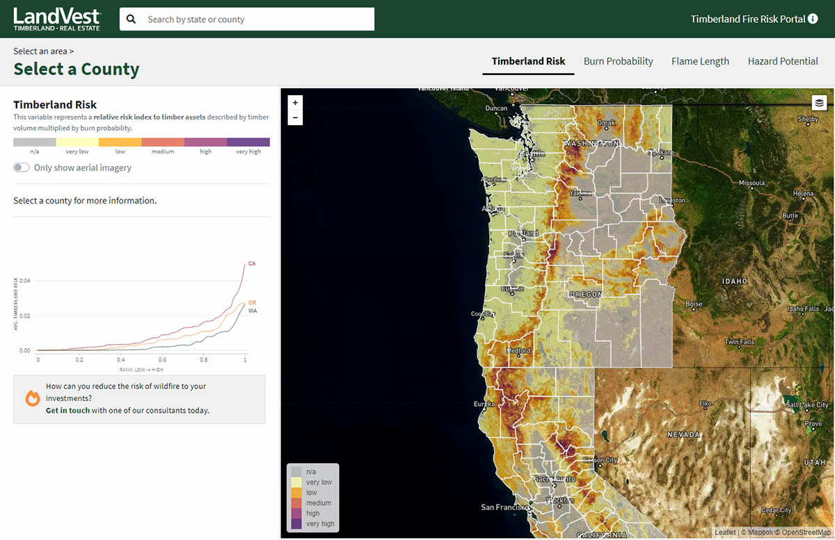
We are excited to announce that we’ve developed a new simple, free tool for viewing timberland wildfire risk in the Western states of Washington, Oregon, and California. It provides a high-level summary of various modeled wildfire risk factors, summarized at the county level, and visible on a map. The wildfire risk factors are based on cutting-edge wildfire risk components created by US forest service researchers, and we’ve added value to these existing datasets by focusing on the risk to timberlands. Visit our new Timberland Fire Risk Portal to learn what the wildfire risks look like on your lands. Reach out to a Landvest consultant today to learn more.
*DATA SOURCE: National Interagency Fire Center – National Fire News Year-to-Date 2020 https://www.nifc.gov/fireInfo/fireInfo_statistics.html
